Please Select a Map Type:
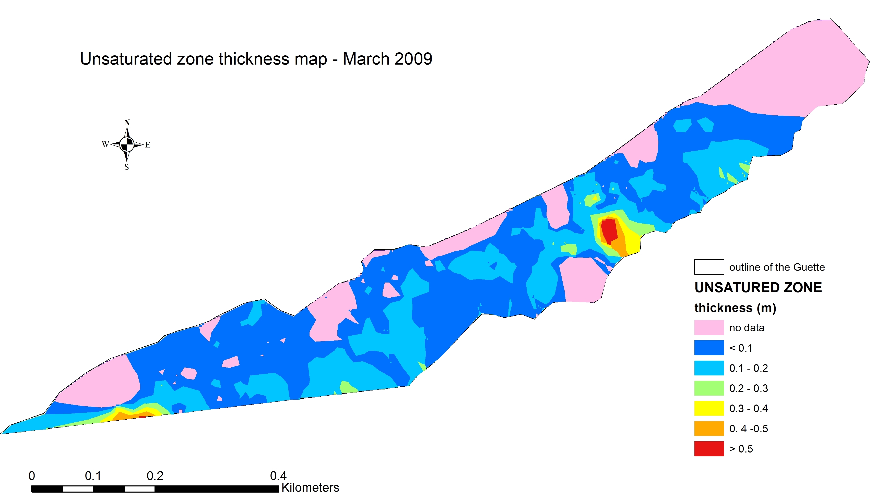
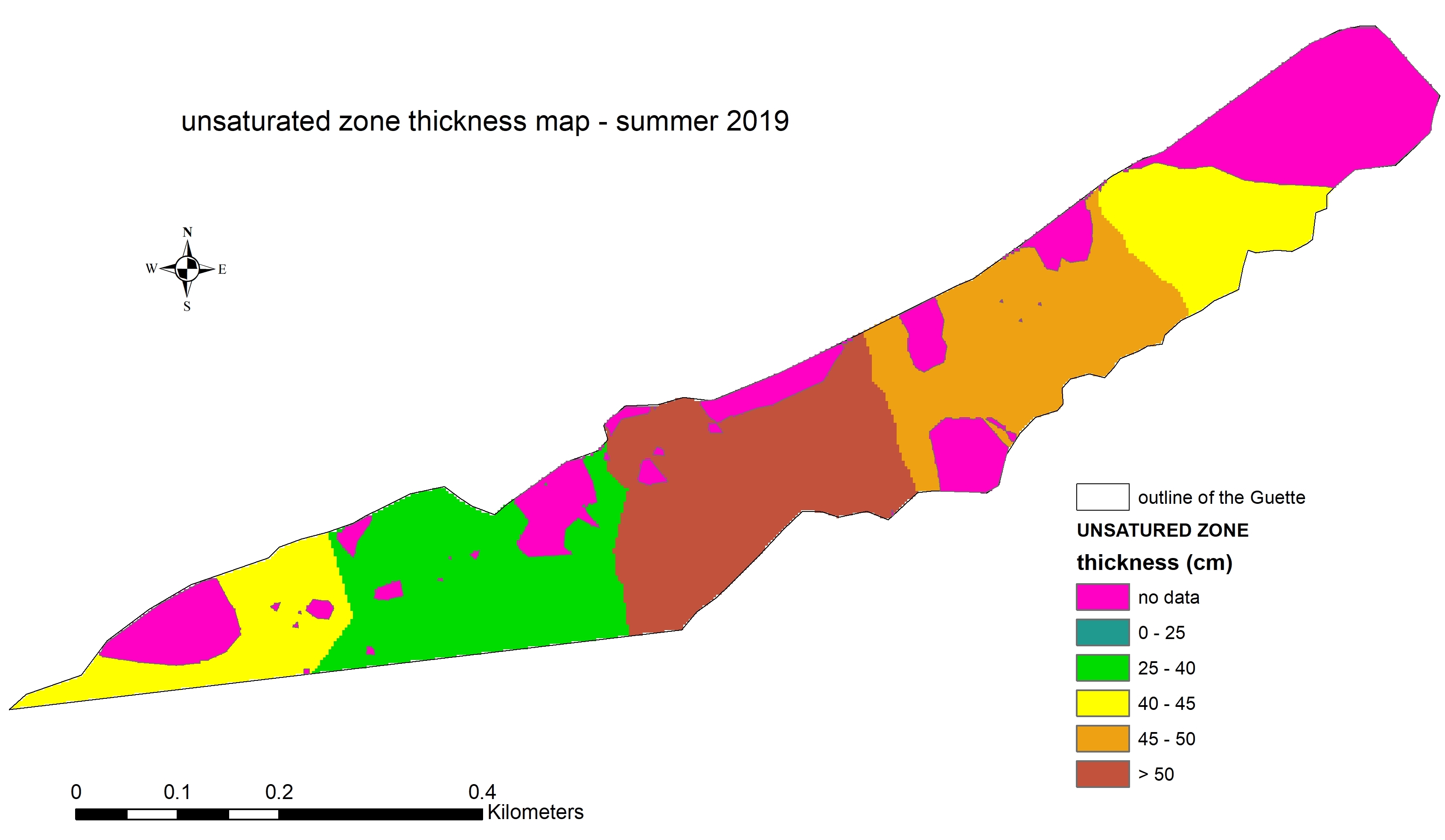
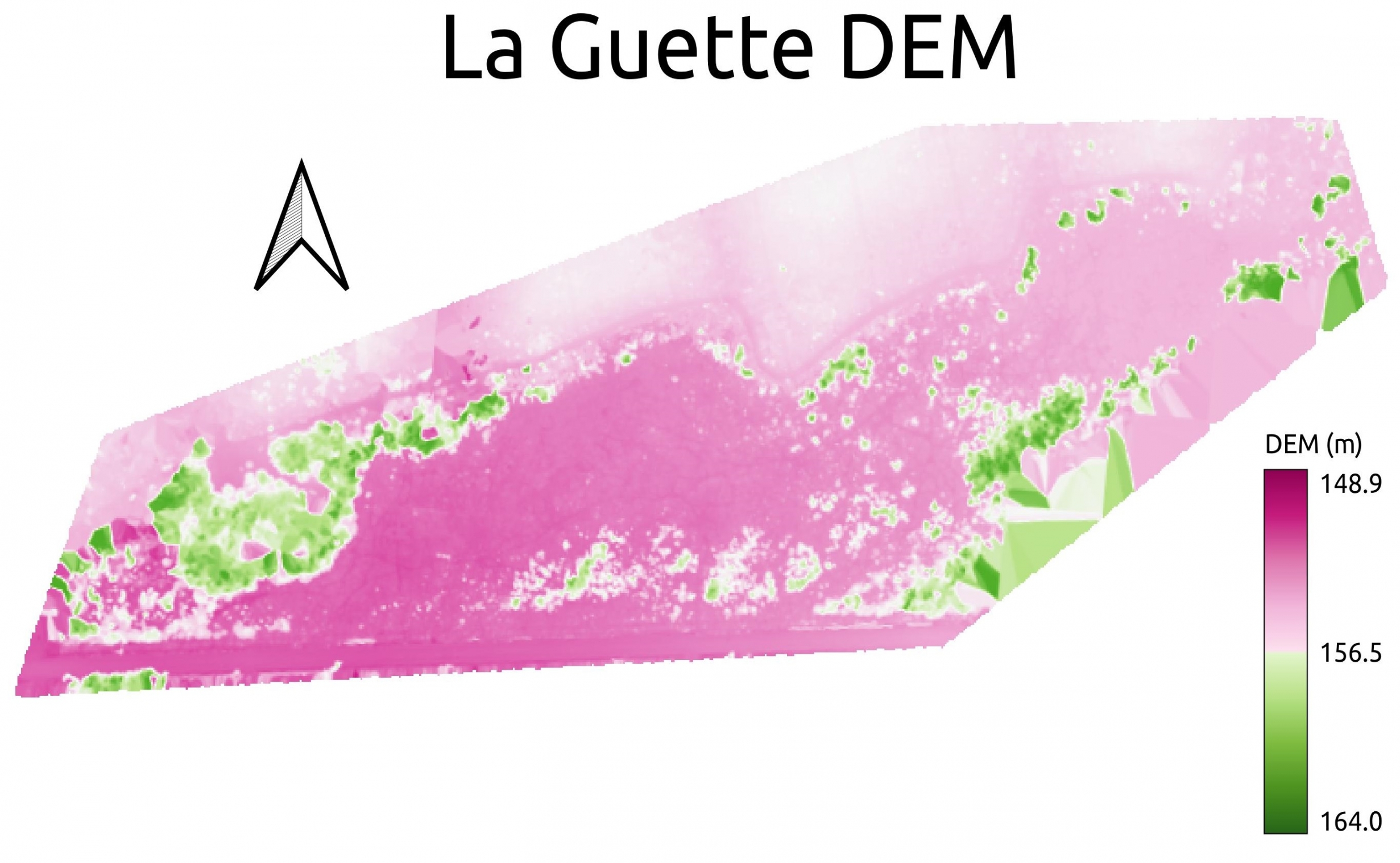
A Digital Elevation Model (DEM) is a type of raster GIS layer. They are raster grids of the Earth’s surface referenced to the vertical datum—the surface of zero elevation to which heights are referred to by scientists, insurers, and geodesists.
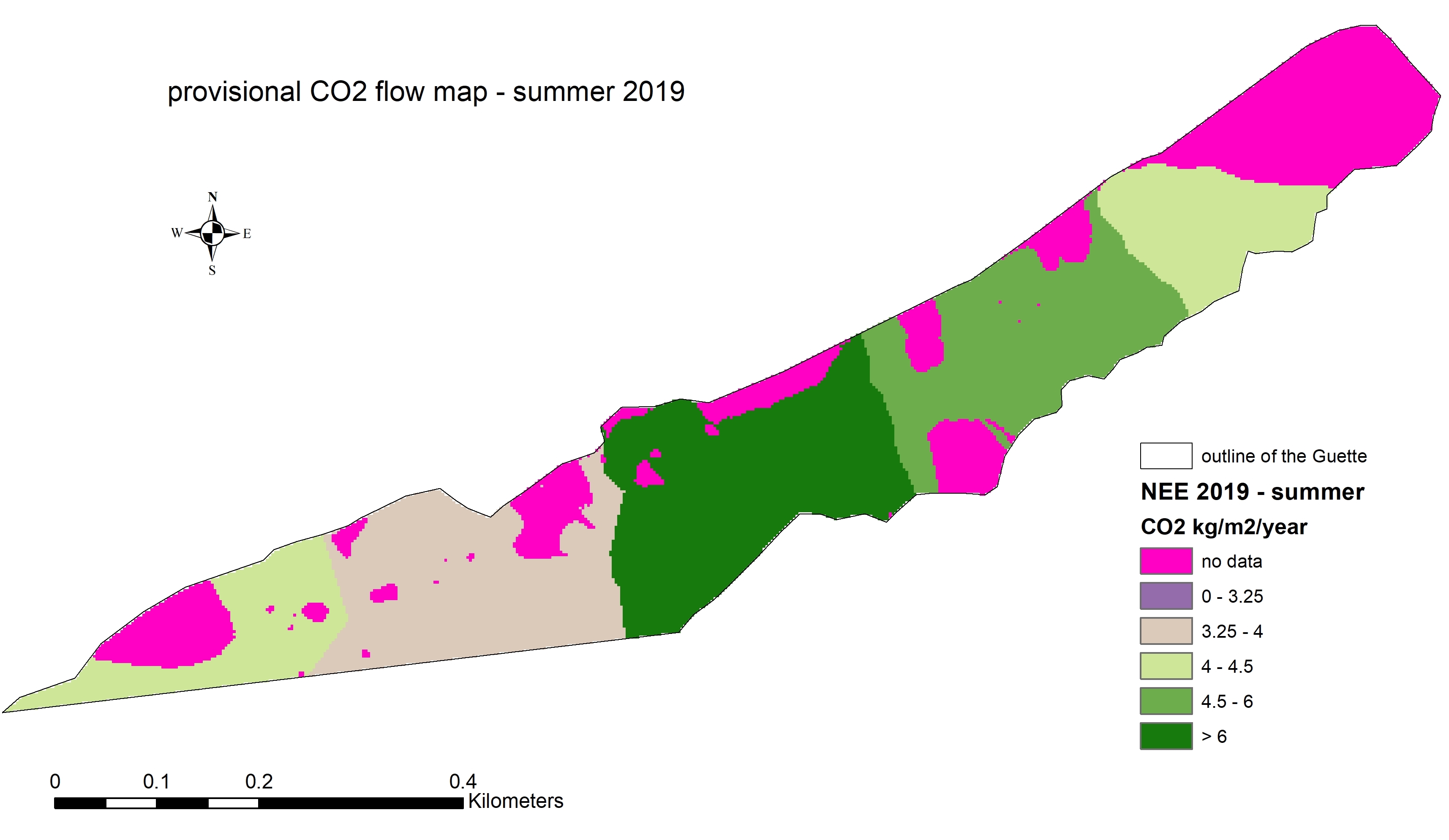
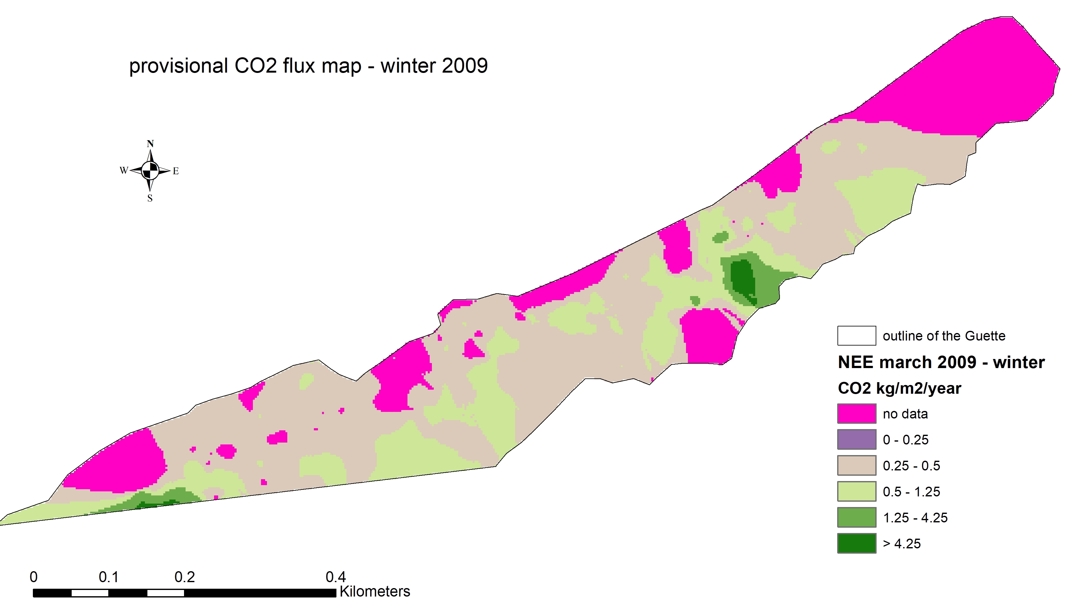
Data collected in October 2019
Map animation