
This site is under development. Please keep in mind that the figure that are displayed may not be fully accurate
Area: 200 Ha
Latitude:
53.39
Longitude:
-7.44
Site Type: Degraded Raised Bog
Sequestration Rate: -6.2T CO2eq/Ha/Yr (Date: __/__/____)
Potential Sequestration: -T CO2eq/Ha/YrNear Natural Status: 65%
Biodiversity Rating: 55%
Peatland Power: 60%
Protection Status: National Heritage Area (NHA)
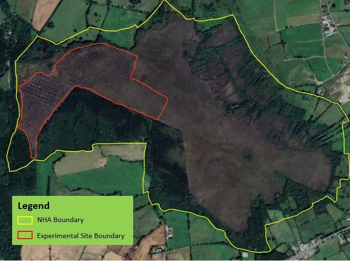
Cloncrow bog is situated in County Westmeath, within the midlands region of Ireland which is the primary area for raised bog formation. Current land uses on the site comprise active peat-cutting to the East of the high bog margin and afforestation on both the high bog and the cutover. Areas of cutover have been reclaimed for agricultural purposes around the site. The grassland is used for grazing. Damaging activities associated with these land uses include drainage and burning of the high bog. These are all activities that have resulted in loss of habitat. The Irish pilot site is located in Cloncrow Bog, designated as a Natural Heritage Area (NHA) which consists of 200ha. The Care-Peat pilot consists of 26ha which will undergo drain blocking and vegetation restoration.
If you want to review the data generated for the Cloncrow bog test site during the Care-Peat project, please browse them in the data page.
The different scientifics maps developed for the Cloncrow bog test site during the Care-Peat project can be found on the map page.
The laws and regulations that are relevant to the Cloncrow bog test site are listed in the policies page.